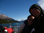
So we stocked up on food and drink (and plenty of fuel for our camping stove) and wobbled out of town up Ruta 9. After about 20km we left the main road and followed a back country road towards the park, past La Cueva del Milodon (a cave where the Chileans once discovered the skeleton of a rather large bear with a dinosaur-like tail and a keen interest in dancing. The remains were subseqently pinched by an English cad who attempted to smuggle them back to the British Museum in some barrels of rum. Doing so destoyed the remains and so now there´s nothing left of the Milodon. It´s a bit of a sore point, like the forrest fires. But now tourists can visit the cave where the Milodon once lived and meet a talking fibreglass replica, and the Chilean Tourist Board gets to charge $12 a pop. But talking fibreglass replicas are just shit, aren´t they? So we didn´t bother stopping.)
The road on towards Torres del Paine was our first experience of the ripio that covers a lot of the roads in Patagonia - a loose surface of stones and small boulders with nothing to hold them together except dirt and dust. On a bike it feels like you are cycling on ball bearings. Suddenly going downhill becomes very unnerving as the road slips away from beneath you and stones ping out from under your tyres. You never really feel in control going downhill, and waste a lot of energy wheel-spinning on the flat or going uphill. There are potholes and ridges everywhere making it more or less impossible to travel in a straight line for any great distance. Every passing car disturbs the surface and throws up a new cloud of dust. After five minutes your mouth is full of grit and everything tastes like Rennie for the rest of the day.
Fortunately you get used to it fairly quickly, and when we returned to a normal paved road a few days later it felt a bit tame...
The park itself was incredible. The range of mountains at the heart of it all (Las Torres) is as imposing as anything you´ll ever see. Enormous black stacks of granite dominate the skyline everywhere you go, and even seem to control the weather, dishing out downpours to the surrounding area. On the Western side of the park you can see the edge of the South Patagonian ice sheet that stretches North for over 500km.
Torres del Paine
We saw some amazing wildlife too - guanacos, Patagonian foxes, rhea, flamingos, all kinds of exotic ducks and geese, Caranchos (big hawks), and Condors (who make Caranchos look like small hawks, they´re more like aeroplanes than birds).
Getting around Torres del Paine on a bike was quite hard work, but it was an incredible place to visit and well worth the pain. And best done without the GoreTex/zip-off trousers/Handycam bunch....


Still having fun?
ReplyDeleteLoving the blogs Laz & Ben, makes a welcome distraction from my exam revision (going badly anyway due to an Anton-induced hangover).
ReplyDeleteHope you are enjoying yourselves & look forward to the next post,
Divya
Yo! Can´t find your email addresses, so I figured we can communicate through this snazy little feature... I´m in Cochrane waiting for y´all... I´ll hit up Paula tonight and if you guys aren´t there, then I´ll head out for the farm and meet you there...
ReplyDeleteSo if we don´t meet in Cochrane, here are the directions to get to the farm:
hang a right on the road that leads to Chile Chico. The farm is about 1.5 km after Puerto Guadal called Destino No Turstico...here are more specific directions they gave me...
reach Camino Laguna La Manga, and follow the red circles that you will find on the right side of the road. Finally you will find an old wooden gate close to a sign UN DESTINO NO TURISTICO. Open the gate and follow the trail until the next gate. Open it and you got it. Follow the red circles to our home.
See you there!
Hi Ben
ReplyDeleteIt's Aid here.
I hope you are okay - we have just heard about the earthquake and are a bit worried for your and Laura's safety.
please let us know mate.
Aid