Donde?


View Pedalling for Peru in a larger map

Tuesday 6 July 2010

The final chapter ... where it all went wrong

So it is with some degree of suprise that we find ourselves in Lima.  After 6 months and some 6000kms of pedalling we`ve reached the end of the road and the final week of what has been an amazing adventure.  We`re both feeling pretty exhausted and ready to get back but a little bit sad that it`s all over and seems to have gone by in a flash.  Mainly though I think we`re pretty glad to be safely in Lima after a few difficult weeks.


We left off last in Puno, where we planned to stay just a night before hitting the final 400kms to Cusco.  Unfortunately I got struck down by a nasty virus that left me bed-ridden for five days.  Watching four hours of back to back Friends re-runs and staring at the same box-like hotel room nearly sent me over the edge.  Puno is not a great town, there´s precisely nothing to do there and by day three Ben was bored stiff of eating on his own and then spending the rest of the day stuck in a tiny hotel room with me watching said re-runs of Friends.  We had two options - spend another four days in Puno recovering and then have less time in Cusco or get a bus to Cusco and cycle the costal route into Lima instead.  Another four days in Puno was beyond comprehension but after five days in bed with no food trying to cycle 400kms at high altitude seemed impossible.   So, it was with heavy hearts that we loaded our things onto a rickety old bus for the 8 hour ride to Cusco.  It was a particularly unpleasant bus ride; bumpy, smelly and all the time we were wishing that we could have been cycling the spectacularly scenic route.  We consoled ourselves with the thought that we could still end our trip cycling the Panamerican highway along the southern coast and hopefully find some interesting spots along the way.


A couple of days relaxing in beautiful Cusco was the perfect remedy.  Our visit coincided with the big Choquekillka celebrations so the streets were filled with dancers from all over the country in traditional dress.  After a few days soaking up the sights of the city, watching the celebrations and even managing to find a few home comforts like baked beans and marmite we decided we couldn`t come to Cusco and miss out on Machu Picchu.  


The machete dance ... not remotely threatening


There are only two ways to get to Machu Picchu - hike the Inca Trail or take the expensive Peru Rail train to Aguas Calientes and then walk the last 3kms up to the site or take a bus.  If you want to do the Inca Trail you need to book at least 6 months in advance and be willing to part with 200 dollars.  Plus I`ve heard that the whole thing is littered with bog roll anyway.  Also I met a girl in Puno who told me in great detail how she`d really 'left her mark´on the Inca trail after eating some dodgy food in Cusco.  So we parted with an extraordinary amount of money to travel exactly 22kms on a train that somehow took 2 hours and made the pilgrimage to Aguas Calientes.  Our plan was to wake up before dawn and trek the last 3kms up to Machu Picchu to try and get there while the ten thousand other tourists were either still gorging themselves on hotel breakfast buffets or waiting for the bus to heave them up the mountain.  We got up at 4am and after a few wrong turns and scrabbling around in the dark we finally found the right trail and started the steep climb up the mountain.  It was beautiful seeing the mountains slowly appearing in the dawn light and after a fairly gruelling hour of climbing we arrived at the top panting and sweating.  As we watched the sun rising over the ruins and lighting up the ancient city it made the early start worth it.  By 10am the whole place was crammed full of tourists, sweltering hot and it took forever to shuffle from one side to another getting tangled up in tour groups and tripping over idiotic hiking poles so we made a swift exit and headed back to Aguas Calientes to start the tedious journey back to Cusco.


Sunrise over Machu Picchu


Back in Cusco we prepared ourselves for the onward journey. We needed to get on a bus to reach Nazca, a desert town in southern Peru, from where we planned to get back on our bikes for the last stretch to Lima.  The road between Cusco and Nazca is notorioulsy dangerous and apparently many tourist buses have been hijacked along the road so we decided that cycling it wasn`t the best idea.  It does also explain why we were forced to provide fingerprints and were videoed as we got on the bus.  Luckily we got to Nazca safely and managed to fit in an overflight over the famous and mysterious Nazca lines.


Lima 420km ... lawlessness and violence 117km


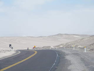
After our quick stop off in Nazca we jumped back on the bikes and spent the day cycling through the desert marvelling at the huge sand dunes.  We arrived in Palpa a small town 60kms north of Nazca in time for lunch and decided to spend the day there.  Our next stop was Ica another 100kms along the Panamerican.  We were confident that we`d make it in a day as we thought it would be flat desert.  


We weren`t really bargaining on having to climb over a big pass first thing in the morning.  Being back down at 400metres above sea level as opposed to 4000metres made the long climb seem like a breeze though, and it was fun actually being able to breathe again.  Luckily the rest of the ride was gently rolling and with a helpful back wind we made it to the outskirts of Ica by early afternoon.  We were actually heading for a small town called Huacachina 5km outside Ica, a desert lagoon surrounded by huge sand dunes that sounded like a good place to stop for a night or two.  Our rubbish map suggested that to get to Huacachina you actually had to go into Ica and thanks to a total lack of road signs on the Panamerican that`s exactly what we did.  Big mistake.  Not only is Ica a total crap hole it`s also swarming with theiving bastards who dragged me off my bike, stole my bag and then threatened Ben with a knife.  It was 3pm on a busy street and noone even blinked an eyelid.  Luckily I had my money and passport stashed in my fanny pack!  Turns out muggings are pretty common in Ica, especially on Sundays because none of the police want to take the Sunday afternoon shift.  Actually it seems they´re pretty reluctant to take any shift, we watched one "on duty" policeman in Huacachina watch 6 hours of solid football while his assistant dozed in an armchair.


The lagoon at Huacachina


So all in all it hasn´t been the most magnificent end to what has been a brilliant trip but we should count ourselves lucky that in 6 months this is the only real setback we´ve had.  Mostly we have met with the most incredible kindness; from Jorge the man that lets cyclists stay at his house for free to Jackie the kindly lady that loaded us into her old Chevy when we got blown off the road, we have met so many generous, helpful and a good helping of truly bonkers people.  We have cycled on some terrible roads passed some of the most spectacular scenery and fought against wind, rain and burning desert heat.  More than once I´ve questioned why the hell we were doing it to ourselves and thrown my bike down in a fit of desperation and more than once I´ve wanted to DHL the damn thing home and slip into a 180 degree reclining seat on a bus but looking back now I´d do anything to start it all over again. 


Our flight home leaves tomorrow morning and the bikes are all boxed up and ready to go.  It seems like yesterday that we were battling the winds in Tierra del Fuego and now we´re heading home a lot fitter, a bit beaten up but with happy memories of  our time pedalling for Peru.


Finally made it to the beach

Saturday 19 June 2010

Onwards into Peru

After a tough journey to Copacabana we decided to take it easy for a few days.  We did climb up the hill that overlooks Copa to see the amazing views of Lake Titicaca and the winding road that brought us into town winding through the mountains but aside from that we did nothing but rest and refuel.  Copacabana beach is not quite up to the standards of its illustrious Brazilian namesake, but we found a great spot on the waterfront for a drink in the sun where we could watch the boats bobbing back from the Isla del Sol.

The next day we were on one of those boats on our way out to Isla del Sol, believed to be the birthplace of the first Incas.  They must have been a fit bunch (or fitter than us at the very least) because the island rises steeply out of the lake and the only way to get anywhere is by clambering up the near-vertical paths and staircases that were built by Manco Capac and the other early Incas.  We stayed in a hotel perched high up on the terraced hillside and had an amazing view of the lake and the some of the tallest mountains in Bolivia - Illimani, Aconhuma, Illampu, and Huayana Potosi, all of which are over 6,000m high.  Given that Isla del Sol is only 6km long, and that it gets 363 days of sunshine a year, there was no excuse for not doing a few good walks so we strolled from one end of the island to the other and found a great cafe with views out over the Peruvian side of the lake.  

After a few days of  island life we returned to Copacabana and headed towards the border with Peru at a town called Yungayo.  The crossing at Yungayo is without doubt the least intimidating border crossing we´ve come across on our trip:  no armed guards, no high fences, no gates, no flags, not even a welcome sign.  Just two small immigration offices and two lengths of chain that span the road to stop anyone driving straight through.  It hardly felt like we were travelling between two different countries.


We´d heard a few reports from cyclists we´d met in Argentina and Chile that they got a frosty reception from the Peruvians, but thankfully during our first few days on the road here this hasn´t turned out to be the case.  In Bolivia we kept on getting attacked by sherpherdesses for some reason.  We encountered quite a few wild ladies with sheep in the hills between La Paz and Copacabana who hissed, threw stones, and chased us with sticks hurling incomprehensible Aymara insults at us.  But in Peru everyone, including the sheep herders, has been very friendly so far.  If anyone has an explanation for the hostile reception from shepherdesses we´d really like to hear it...


On our first night in Peru we stopped in Juli, a small town on the edge of the lake with five colonial churches, a great Sunday market and lots of people selling cups of jelly on the street.  The day after we cycled on to Chicuito, just outside Puno, and spent the afternoon at a brilliant mirador with great views of the lake and the mountains beyond.  Neither Juli nor Chicuito gets anything like the volume of tourists that you find in Copacabana or Puno, and it felt like the people there were far more welcoming as a result of not being swamped by outsiders.


The next morning we trundled round the edge of Lake Titicaca and into Puno, where we are having a rest before starting the ride through the Sacred Valley and up to Cusco.  A few days ago we decided that we´ll stop cycling when we get to Cusco for a couple of reasons.  Firstly we´ve heard that the road from Cusco to Lima is essentially a truck lane, so it´s not exactly scenic and certainly not a very fun place to be on a bike what with the fumes (rumour has it some trucks in Peru still run on coal) and the insane Peruvian truck drivers who have already demonstrated their disregard for cyclists amply.  The other good thing is that it´ll mean that we get to spend a bit more time exploring Cusco and Lima, rather than staring at the back end of a truck.


Wednesday 9 June 2010

La Paz to Lake Titicaca

We´ve spent the last week and a half in noisy, busy La Paz.  The capital is a crazy place, not just in terms of it´s location in a huge bowl where the houses cling to the sides of the steep hills and the streets are so steep you almost feel like you might fall off them but also the general chaos and traffic.  Every street is lined with market stalls selling anything from freshly squeezed juices to dried baby vicunas (a bit like a llama but smaller).  I don´t think I´ve ever seen so many buses and mini buses crammed with people, hanging out of every window and clinging to the roof racks.  Most of the buses look like they´re on their last legs but they seem to defy gravity by hauling themselves up the precipitous hills.  Must be the Virgin Mary figurines stuck to the dashboard.  Every bus has a tout that hangs from the door of the bus shouting out the route.  They have an amazing talent for talking unbelievably quickly, I think they´re all South American football commentators in the making.  The micro touts, the endless honking horns and the bustling markets make La Paz an unforgettable, noisy and smelly place.

We left the bikes and all our luggage in La Paz last weekend to fit in a quick side trip to the beautiful whitewashed colonial city of Sucre.  Sucre used to be the capital of Bolivia and a as a result has many grand old colonial buildngs and a beautiful cathedral.  It´s called the white city of Bolivia as all of the houses and buildings are whitewashed making it seem far more civilised than bustling La Paz where haphazard houses seem to grow out of the steep hillsides.  Our trip to Sucre coincided with the first vintage car rally so the main square was crowded with vintage cars from all over the country.  All of the streets were closed off to traffic  and for two days a variety of vintage cars in varying stages of decay raced around the streets of Sucre.  It was a bit like being in Monte Carlo, except most of the cars seemed to have a maximum speed of about 30kmh and were forced at regular intervals to give way to packs of stray dogs lounging in the middle of the road or very old Bolivian ladies with huge bundles on their backs crossing the road very slowly.

After a great weekend in Sucre we bussed it back to La Paz for one final night before jumping back on our bikes and heading for Lake Titicaca, apparently the highest navigable lake in the world at 3800m.  The border with Peru runs across the lake and we´re not sure if this is why the lake is dotted with Bolivian naval bases or because they´re still seriously bitter about having their bit of coast stolen by Chile and Peru and are plotting some extravagant naval manoeuvre to get it back.  The only problem seems to be the lack of any serious military vessels.  As far as we can tell the full extent of the naval training that goes on here is running tourist cruises across the lake on catamarans with on-board restaurants. 

The Inca´s believed that Lake Titicaca was the birth place of the sun so it is considered a sacred lake and it´s not hard to see why.  Backed by the huge snowy peaks of the Cordillera and with deep blue waters it is absolutely beautiful and so, so peaceful after the constant noise of La Paz.  We´ve been looking forward to cycling Lake Titicaca for a long time, not just for the scenery but we imagined we´d be ambling along the shore side on gently rolling roads.  Yeah right.  Yesterday was an absolute killer.  We had to take a bus 50kms or so out of La Paz to avoid being run over by one of the maniac bus drivers and were droppped off in Huatajata, a sleepy little fishing village on the shore of Lago Menor, the south eastern leg of Titicaca.  We were hoping to make it to Copacabana, the main stopping off point on Titicaca, 70km away.  After about 20km my visions of the gently rolling road were shattered.  The next 50km saw us cycling up to 4300m and then being sent back down to 3800m to cross the Tiquina straits on a very rickety raft before going back up again to over 4300m.  You cannot imagine how hard it is to cycle uphill against a headwind at over 4000m.  It´s hard to breath let alone move your legs.  We had to push our bikes in some parts as our legs had turned to lead and refused to pedal.  We literally pushed for 100 metres and then stopped wheezing to catch our breath.  I was seriously beginning to doubt whether we would make it to Copacabana that night and was less than amused at the thought of camping at over 4000m.

Luckily for us 7km from Copacabana and just as the light was dissapearing we had a long downhill into town, arriving just before sunset,  Freezing cold and exhausted but relieved at narrowly escaping a chilly night in the tent we found a cheap hostel and a bowl of steaming quinoa soup.  Copacabana is a sweet lakeside town, a bit like the real Copacabana only less bikinis and more Gore-Tex.  Tomorrow we head off on a boat to Isla del Sol, the actual birth place of the sun.  The island only has 200 inhabitants and there are no roads and no cars so it should be a lovely place to spend a few days exploring the many Inca ruins.

Next stop is Peru, the border is just 10km down the road.  It´s our fourth and final country and we´re now something like 600km from Cusco and the finish line ....

First days in Bolivia

After an epic day on the road to La Quiaca we got up early and made our way to the border crossing.  Bolivia and Argentina are divided by the ironically named Rio Grande - a feeble dribble of water that really doesn't justify a bridge in order to cross it.  In any case it has a bridge and you leave Argentina on one side to arrive in Bolivia once you reach the other side.  Who owns the middle bit, nobody knows.

It was market day (as it seems to be every day in Bolivia) and so we were immediately immersed in total chaos.  Banana sellers, men with little carts whisking up homemade juice, women selling alapaca socks, hand woven blankets, pan pipes, fake Chelsea shirts, pirate DVDs and other authentic artesanal stuff.  All in all it made for quite a contrast with the calm of the Argentinian streets we were used to.

Our first destination after leaving Villazon was Uyuni, home to more markets and artesans and the world´s largest salt flats.  Uyuni itself is a fairly unpromising town on the railway line that used to run all the way from the mines of Potosi to Buenos Aires, so we wanted to get out onto the salt flats as soon as possible.  For a couple of reasons we decided to leave the bikes in town and hop in a jeep with a guide: firstly our bikes are made of steel and so we´d have to cover them in grease to stop them rusting; secondly we wanted to go and see some of the volcanos and lakes between the salt flats and the Chilean border, which involves crossing some quite inhospitable desert and requires a lot of local knowledge to avoid getting horribly lost (not to mention running out of water because it´s a desert and having to camp in areas where it can get as cold as -65f at night).

On the first day we drove out into the middle of the salt flats and visited an incredible island covered in cactus and outcrops of coral that died 40,000 years ago (when the sea that was once here dried up) and became fossilised.  Whichever way we looked we could see nothing but pure white salt, and dark mountains floating like islands in the distance.  The Salar de Uyuni is so big (12,500 sq. km) and so featureless (except for the two islands in the middle) that driving across it was a an extreordinary experience.  It felt like you could drive for hours and hours and still not make any progress towards your destination.

Still after a lot of driving in a straight line we made it off the salt flats we stopped at another relic from the days when this whole area was under water - La Cueva de Galaxia.  Miguel, the man who discovered La Cueva de Galaxia in 2003, showed us around his amazing find.  Whilst searching for a Pre-Inca burial ground Miguel and his friend Walter came across the entrance to a big cave that had become blocked with silt.  They dug through the silt expecting to find the Pre-Inca mummies they were searching for but instead were greeted by the incredible sight of two chambers full of fossilised sea weed and coral that have formed strange bone-like outcrops and stalactites that look like they belong on another planet.  (We´ll put some pictures up soon)

After marvelling at the caves we headed off to find somewhere warm to stay before the sun set and it got too cold.  We ended up sleeping in a hotel built entirely out of blocks of salt - salt walls, salt floor, salt tables, salt chairs, salt beds, salt everything (except the windows and the loo).  The next day we woke up really early and stood brushing our teeth outside the salt hotel and watching the sun rise over the mountains before driving off towards Oliague, a giant conical volcano that towers over a valley full of strange sandstone shapes.  The rocks have been carved by the wind over the centuries into all sorts of unearthly forms, and are host to some really strange looking plants, including giant green lumps of moss about the size of a car and the shape of a brain.

Next our guide drove us on to a sulphurous lake that is home to Flamingos and Storks.  On the day we visited there were only two Flamingos at the lake, but they were being very cooperative and standing near the edge so that we could get a good look at them.  We slept by Lago Colorado, where there were a few more Flamingos, and on the way there we were lucky enough to see a mountain fox chewing on some bones by the side of the road.

The next morning we got up at 5am and drove all the way up to a geyser field called El Sol de Manana, almost 5,000m up.  It was freezing cold and still dark when we reached the geysers, but the sun was about to creep over the horizon so the clouds in the distance were bright red.  When we got out of the car for a closer look the red sky and the thick clouds of smoke blowing across us from the geysers created quite a spectacle.

A few hours later we stopped for breakfast by some hot springs.  We decided to leap in the hot springs first.  There was a howling wind blowing and it was still so cold that we were wearing literally every item of clothing in our possession, and so we had to psyche ourselves up for putting on swimming trunks and jumping into the springs, but once we were in it was like being in a bathtub.  We sat there defrosting in the water and basking in the morning sun but eventually had to summon up the courage to get out and get some breakfast.  On the short walk from the springs to the comedor our swimming trunks and hair froze solid in the icy wind!

After breakfast and a very, very long drive we eventually made it back to Uyuni and were reunited with our bikes for the trip on to La Paz.

Wednesday 26 May 2010

The last of Argentina

We made it to La Quiaca, the border town with Bolivia, late last night after a very long day covering 100km against a horrid headwind.  We´re both feeling the effects of the altitude too which makes pedalling even more of a struggle but we were determined to make it to La Quiaca last night for a warm bed and a hot shower after a freezing night camping at 3700m the night before.  We knew it had been pretty cold when we woke to find all of our water had frozen as well as the eggs we´d bought for breakfast.  Luckily we woke to a beautiful sunny day so we ate our scrambled egg icecream in the morning sun and gradually let our frozen bones thaw out before hitting the last leg of the Argentine phase.  It seemed fitting that our last day of cycling in Argentina also coincided with the Bicentenary celebrations so we woke up to fireworks and music from the nearby village of Tres Cruces. 

We will cross the border into Bolivia this morning, 4 months and 4 days after leaving Ushuaia, which according to the sign on the outskirts of town is now 5121km away.


Sunday 23 May 2010

Quite a lot of quebradas

We left Purmamarca this morning and are now in a place called Tilcara up in the Quebrada de Humahuaca, an amazing canyon that runs from above San Salvador de Jujuy up to the altiplano that borders with Bolivia.  As it stands we are now just 207kms from La Quiaca, the Argentine border town where we´ll be crossing into Bolivia. Our stop in Tilcara is a brief one, to use the internet and stock up on some food before heading on.  We´re hoping to reach the town of Humahuaca, 50kms north of here, tonight.  That´s assuming the next lot of climbing isn´t too horrendous and the wind decides to be kind to us.

Tilcara is a nice town, adobe houses and plenty of artesans selling all manner of alpaca ponchos, leg warmers etc.  (Ben bought some llama-adorned alpaca gloves yesterday, what a gap-year tragedy!).  The last couple of days have been pretty long and tiring as we´ve wound our way up from 1100m above sea level to 2500m.  Yesterday we climbed1500m over 80kms to reach the beautiful village of Purmamarca, famous for it´s Cerro de los Siete Colores - a multicoloured sandstone hill that´s amazingly beautiful.  Safe to say we are feeling a little weary and the air is beginning to feel a bit thin but the scenery is more than enough to distract us from the never ending hills and shortness of breath.

Before setting out on this last leg of the journey we had a lovely stop over in Salta, a beautiful colonial city with more than enough restaurants, bars and museums to keep us entertained for a few days.  It was also the last Argentine city we´d pass through as we decided to give Jujuy a miss and opted instead to spend the night camping on an airstrip a few kms outside of town.  It was a great spot with wonderful views of the mountains that we´re now trundling up, marred only slightly by the fact that the guard dog (a strange mongrel with 3-inch legs) barked at our tent all night. A sleepless night wasn´t the best preparation for one of the hardest days´cycling to date. 

The Quebrada de Humahuaca has been declared a UNESCO world heritage site and the Provincial government of Jujuy claim it as the most beautiful zone in all Argentina.  It is a remarkable landscape, no doubt about it, but it´s the second Quebrada we´ve cycled through in as many weeks so we´re still trying to decide which out of the Quebrada de las Conchas, north of Cafayate, and the Quebrada de Humahuaca is the most spectacular. 

Well, this is just a quick post to update on our progress and we´ll write more and upload photos when we next find a computer. 

Saturday 15 May 2010

Parrots and hamsters on Ruta 40

We left Tafi del Valle four days ago and followed the road towards Salta. It heads North East out of town and crosses the mountains behind Tafi at their lowest point - El Infiernillo (little hell) - at over 3,000m before swooping down into another valley and reaching the town of Amiacha.


Amaicha sits in the Valle Calchaqui between two mountain ranges with peaks almost 5,000m high to the East and West. There´s a sign in the Plaza de Armas that tells visitors that the town has a population of 5,000, lies 1,987m above sea level, and gets 360 days of sunshine each year. On a bright Saturday afternoon you couldn´t imagine a nicer place to be.
Having spent the night in Amaicha we rolled downhill to join up with the Ruta 40 once again. Not far from the main road are some Pre-Incan ruins which we visited. The stone walls and paths built into the hillside are the remains of a settlement belonging to the Quilmes Indians dating back to 800AD. The ruins themselves have been restored but the area feels really unspoilt, so you´re able to get a feel of what life must have been like for the people that lived there. From the very top of the ruins the views across the valley were incredible.


We left Quilmes and set our sights on Cafayate, Argentina´s second biggest wine town after Mendoza. The Ruta 40 passes through some beautiful little villages on the way and we were easily lured into one of the bodegas by the side of the road for a mid-afternoon wine tasting session. The road to Cafayate was flat and fairly easy going (except for a few bits towards the end of the day when the wind got up) and the views down the valley were breathtaking. Brightly coloured layers of rock in the distant mountains looked awesome in the late afternoon sun. We saw wild hamsters running between burrows by the side of the road, and lots of bright green parrots swooping overhead. There was the usual smell of decaying road kill on the wind from time to time but we´ve got the knack of holding our breath when we see a carcass approaching...
 
Cafayate in Autumn is quite beautiful. The leaves are turning on the trees and the vines and the town pops up out of the scrub of the valley (where nothing grows except wirey bushes and the kind of comedy cactus you find on the menu of any self-respecting Tex-Mex restaurant) like an oasis. As you come into town it´s hard to miss the main square and we sat and rested our aching limbs there, watching the world go by for a few hours before finding a place to sleep for the night. 

The next day we got up and decided to go and explore the Rio Colorado that lies about 5km out of town. We were expecting a fairly tame stroll through some woods to the big waterfall that everyone tries to find, but it turned out that the walk was not for the faint-hearted. In fact by most people´s definition it wasn´t a walk. Almost immediately we found ourselves having to clamber over enormous boulders and hang on to rocky ledges for dear life in order to follow the river up into the mountains. Luckily we had a guide to help us out along the way, and we saw some incredible waterfalls. The swimming was not for the faint-hearted either. Aparently the best months for swimming in the waterfalls are December to February. After that the water gets a bit chilly, so we decided to stick to paddling...

Friday 7 May 2010

The Northern provinces

We´ve been back on the road for 10 days now after a wonderful 2 week break.  We spent 4 days milling about in Mendoza tasting wine at the Trapiche Bodega before winging it up to Cordoba and having the most relaxing and wonderful stay with Paul and Christine in La Cumbre.  Our break marked the half way point in our trip and was also sadly time to say goodbye to Danny and Team Pichanga.

Rehydration is the name of the game.


It was difficult to say goodbye to Paul and Christine after such a wonderful stay - we were so well looked after, so well fed and so well entertained.  But time seems to be flying past and we are wondering how we´ll ever make it to Peru in time so after a final lunch with Paul we heaved ourselves (literally) back on our bikes and headed out of La Cumbre with no real idea about the road ahead just a vague notion that we needed to keep heading northwards.  Our late start that day meant that we only made it about 30kms from La Cumbre before calling it a day somewhere between Capilla del Monte and the historic village of Ischilin, where we planned to make a stop the next day.  Being back in the tent came as quite a shock so we made an early start the next day and wound our way up the rather rough track to Ishcilin.  The road was covered in a layer of deep sand, making pedalling up the steep hills hard work and coming down the hills more like skiing.  Still, we made it to Ischilin that night and treated ourselves to a night in a lovely hospedaje.


The next morning we got an early start and made it to the town of Dean Funes in no time at all.  The only thing that stopped us on our way was the sight of the most enormous pig lying by the side of the road.  Everyone here seems to keep a pig grazing by the side of the road, and they seem to have two main roles: 1. Providing sausage meat at some point in the future.  2. Eating rubbish meaning that all the owners have to do is dump their rubbish on the side of the road and leave the pig to do its thing.  When we arrived in Dean Funes we were greeted by a slightly overzealous Police officer who, suspecting that we might be the 21st century incarnation of the Wild Bunch, insisted on taking down our details.  Dean Funes provided us with the opportunity to stock up on food, but didn´t seem to have much else to offer, so we decided to carry on to Villa Tulumba.


Tulumba is a sleepy little town by day, with a beautiful church and many surviving elements from the arrival of the Spanish at the start of the 18th century, but by night it turns into a hive of activity with several dive bars and a nightclub that doesn´t turn down the volume until the sun rises the next morning.  Sadly the owners of the only campsite in town were away so we were forced to take a room in some man´s house.  On first glance things looked fine but on closer inspection it was clear the sheets had never been washed and the whole house smelt overwhelmingly like a septic tank.  Needless to say the combination of pumping techno, barking dogs, cockerels and the pungent aroma of drains made for a fitful nights´sleep.  We left early the next morning feeling like we hadn´t really been to bed at all.

We rode on the next day through some beautiful rolling farmland that could have been in the home counties, and after a lunchtime stop at a roadside parador for beer and crisps (lunch of champions) we made light work of the 80kms to Villa Maria del Rio Seco, arriving in time to enjoy the early evening sunshine and get a taster of the Primer de Mayo celebrations, which like most holidays in Argentina seemed to involve lots of meat, a rodeo and a helping of drunk gauchos.  Feeling fairly exhausted after a long day on the bikes we treated ourselves to a clean bed and some amazing roast chicken in the only restaurant in town, that happened to be on the forecourt of a petrol station.

Next day it was back on the bikes and we cycled all morning up and down endless hills and through torrential rain to get from Villa Maria to Ojo de Agua where we planned to stay the next night.  Ojo de Agua is one of the worst junction towns we´ve seen, full of mentalists and unbelievably depressing.  It didn´t offer much in the way of appealing sleeping options or for that matter appealing eating options so we decided to keep going and try to get to Santiago del Estero as quickly as possible before we were eaten alive by any one of Ojo´s mental one-toothed residents.

Santiago del Estero was the first Spanish settlement in Argentina.  From the guide book it sounded like a good stop off and after some research we found three things that we really wanted to do there: visit the Museum of Anthropology; see some of the original colonial architecture; and sit and relax in a legendary bookshop that´s also a bar.  Sadly we failed on all three fronts: the Museum was closed because they were moving it to a different building; all of the colonial architecture (bar the Cathedral) has been knocked down; and the bookshop/cafe/bar has gone out of business.  Still, we got to stay in the Savoy Hotel (likely to be the only Savoy we´ll ever be rich enough to spend the night in) and had a good rest for a few days.


Feeling rested and ready to take on the next long stretch we took the very long and straight road out of town thinking that we´d spend the night in Termas del Rio Hondo, a spa town 70km away, but got there to find that all it had to offer was a lot of seedy overpriced hotels and a filthy campsite that smelt of raw sewage.  We decided to keep going north and ended up camping at a local football club on the edge of the pitch.  This was also covered in rubbish but at least we didn´t need to pay for the privilege of sleeping on a landfill site.


The next day it was insanely hot but we managed to record our longest day of cycling yet - travelling almost 95km from the football club to Santa Lucia.  The views from the road to Santa Lucia were incredible with the Andes looming in the distance like a giant wave getting gradually closer to us.  In the last few days the notion that we´ll soon have to get over that 5km high wave in order to get to Peru has become increasingly real.

The ride from Santa Lucia to Tafi del Valle was one of the hardest day´s cycling so far. Starting at 400m above sea level the road goes up and up and up for 60km before reaching the upland plane that Tafi del Valle sits on, 2,100m up.  We knew it would be a hard day´s work so we started early, reaching El Indio (a 50ft high statue of an Indian about to throw a spear into the valley below and some artesans selling ponchos and dulce de leche-themed snacks) in time for elevenses.  It suddenly felt like we were cycling through those classic Andean valleys that you see in films with creepers hanging thick from trees enveloped in mist.  From El Indio we kept on climbing (lots of hairpin bends - we counted at least 24) until we found ourselves deep in the clouds.  Despite our determination to keep going the fog was so thick that we could hardly see the road ahead and were in real danger of being knocked off the road by cars and trucks battling through the downpour.  At this point a small roadside cafe came to the rescue, providing us with a warm drink, homemade alfajores and shelter from the pouring rain and freezing cold.  It was hard to beleive that we´d set out that morning in sweltering heat and ended the day surrounded by clouds wearing every single item of clothing and still shivering.  We finally made it to Tafi that evening and headed straight out for steak and chips, a fitting end to an epic day.


At the moment all of the hills around Tafi del Valle are masked by clouds so we can´t really appreciate the beautiful views but it has the laid back feel of a typical hill station.  We´re staying in Estancia Los Cuartos, which dates back to 1617.  It´s probably the most traditional Estancia we´ve visited so far, and the perfect place to rest given that the weather isn´t so great, with lots of thick alapca rugs everywhere and (supposedly) great views of the surrounding hills.

Monday 26 April 2010

Half way. How did that happen?

If you were wondering why we've gone so quiet of late, we've been busy trying to haul ouselves through the neverending desert that leads to Mendoza, and it has been an epic journey.

We're at the half way point of our trip in more ways than one:

1. We're more than half way through the 167 days between our departure from Ushuaia on the morning of 21st January and our flight home from Lima on 7th July.

2. According to the ACA distance finder Medoza is 3,234 kilometers from our staring point in Ushuaia, and slightly further by the circuitous route that we've taken through Patagonia, meaning that we've covered roughly half of the estimated 7,000km from Ushuaia to Lima.

3. The seafront atUshuaia is located at a latitude of 54° South and the centre of Lima is at 12°, meaning that the mid way point in terms of latitude is 33°25'S.  Mendoza is at 32°.

Hurrah!  After all that hard work we've decided to take two weeks of rest (on the naive assumption that we'll do the second half faster than the first half...). 

Thursday 1 April 2010

Wind break

We´re currently on a wind break in Zapala.  It´s not a town made in heaven but it has everything we need.  In the last few days a nasty storm has been firing violent bursts of wind our way making cycling due north (which is what we need to do in order to leave Zapala) a dangerous occupation. 


Ruddy wind.  At it again.

Our journey here from San Martin de los Andes has been great fun.  We roared up Ruta 40 to Junin de los Andes, a quiet and much underrated place that gets little attention in most guide books, and spent the afternoon basking in the sun and swimming in the river.  Having stocked up and food (and got some free advice from a local wine merchant on the scenic route out of town) we took said scenic route towards Alumine and Zapala beyond.  It was a clear day and without a cloud in the sky we had an uninterrupted view of Volcan Lanin, caked in snow and towering 3,776 metres above us near the Chilean border.  The dusty road gradually dragged us up high into the hills before dropping us back down into the river valley that runs the whole way into Alumine, so at the end of day one we´d done a lot of climbing.  Exahusted and caked in dust, we were ultimately rewarded with a swim in the beautiful clear river near the village of Pilol Lil.

Volcan Lanin

The river near Pilol Lil.  Perfect for swimming.


Extraordinary rock formations in Pilol Lil

From there we expected to wind around the valley a bit more before branching off onto the road to Zapala, and be able to cruise into town later that day, if not early the next morning.  Our expectations were based on two things:  advice handed out by someone who had clearly only made the journey by car;  and on a map that (like most maps of South America) turned out to be as accurate as a pissed sniper who has been handed someone else´s varifocals.

By late afternoon we´d done lots of upping and downing over various lumps in the lanscape (The Andes?), but only managed 50 of the 120 odd kms to Zapala.  We thought we´d try to push on for a bit to get the distance to town down to a manageable figure for the following morning until we turned a corner and came face to face with Cuesta Rahue, a mountain pass over 2,000m high.  Eyeing the all-you-can-eat hairpin buffet ahead we decided to find somewhere to camp for the night so that we could attempt the climb with fresh legs in the morning.

Cuesta Rahue seen from the AVN hut

Then we spotted Carlos, a man employed by the AVN (equivalent of the Highways Agency we think) to sit in a hut at the bottom of the pass and keep watch.  He has to check that the road is passable, make sure that nobody gets stuck on the pass, and prevent people from doing anything stupid like crossing it in winter without snow chains, or trying to drive up there in a Rover 200.  Anyhow, Carlos kindly said that we could camp the night next to his hut and use his kitchen, bathroom etc, so we spent a very restful evening admiring the amazing view of the valley (that probably keeps Carlos from going insane with boredom) and watching rickety trucks narrowly avoid overshooting one of the hairpin bends (an event that would probably punctuate Carlos´ boredom, but not in a good way).

The start of Cuesta Rahue

The big climb.  Like a massive intestine clogged with grit.

The next day we got up early and took on the climb.  It wasn´t as horrendous as we´d expected, and on the downhill on the other side we set a new tour best of 64.1kph.  But the bad news lay ahead and we discovered that several more big climbs lay between us and Zapala.  Exhausted, we spent another night sleeping in the mountains, watching the sun set and the moon rise over some amazing scenery, trying to cook something vaguely appetising with our remaining food, and trying not to be fooled by the hallucinations that seem to make rocks and stones look like biscuits in these extreme hunger situations.


Cuesta Rahue - not for the faint-hearted

Camping, just not in Zapala as we´d expected.


Finally (on our third day of trying) we made it to Zapala.  The extreme wind that is currently holding us back was in fact a real help getting here.  We managed to outrun the rain and covered 45kms in two and a half hours (ish). 

At some points we were cursing the decision to take the scenic route, but in hindsight it was a great detour.  Fingers crossed the wind will fizzle out overnight and we´ll be able to roll on towards Mendoza tomorrow.

Friday 26 March 2010

Back in glorious Argentina

We are now in San Martin de los Andes, a lakeside town 200km north of San Carlos de Bariloche in the Argentine lake district.  We got consistently rained on in Chiloe and slightly fed up with the busy roads so have hot-footed it back to Argentina, where it´s cheaper and the food is better.  Chile must be the 'comida rapida' capital of South America - they are obsessed with chips and hot dogs and are proud to call 'Pichanga' (a dish consisting of a huge mound of chips topped off with deep fried chorizo, hot dog, beef, cheese, pickles, avocado, olives and hard boiled eggs) a local delicacy. Safe to say the novelty of fast food was wearing very thin so we sped up to Puerto Montt from where we planned to cross back into Argentina via the Cruce de los Lagos, a border crossing which involves some 200km of cycling, four lake crossings and finally drops you on the Argentine side of the Andes just below Bariloche.

We arrived in Puerto Montt in torrential rain, it definitely felt as if Autumn had arrived and we were thinking our luck with the weather may have run out.  Puerto Montt came as quite a shock after emerging from Patagonia - it´s a dirty port town that looks like it´s definitely seen better days.  We found out that the lake crossing into Argentina is now only sold as an all inclusive excursion and would have set us back 200 dollars so we made a snap decision to jump on the bus to Bariloche in a bid to escape the rain, grotty Puerto Montt and more hot dogs!

 Getting blown away in Bariloche

After a night in Bariloche gathering supplies we headed north out of town on Ruta 40 pedalling through the Valle Encantada, an eerie valley with strange rock formations.  The terrain looked so similar to what we´d seen much further south in El Calafate so we felt slightly like we´d backtracked on ourselves.  After a solid day´s cycling we were overjoyed to see a sign for camping and parilla.  Ben´s eyes lit up at the thought of the juicy barbecued cordero that he´d been craving pretty much since the day we left Argentina at El Chalten. The campsite was on the site of what had once been an old Almacen built in 1914 by the current owners´ grandparents.  The old store is now a small restaurant and you can still see the worn out dip in the wood floor where the old counter had once been.  Apparently Che Guevara stayed there on his motorcycle tour, so we felt in good company. Unfortunately our day´s budget didn´t stretch to both cordero and camping so poor Ben went to bed still dreaming of lamb.

The Valle Encantada


Next morning we turned off paved Ruta 40 and onto Ruta 234 also known as the Ruta de los Seite Lagos.  It's a 150km gravel road that winds past 7 beautiful lakes, through rain forests and 3 national parks before ending up in San Martin.  The scenery was fantastic, marred only slightly by the terrible head winds that hit us from Lago Traful. We finally made it the 50km to the small lakeside village of Villa Traful at 7pm that evening. Exhausted and starving after some rough stretches of gravel, some unexpected climbs and a big dose of head wind we hit the local mini mercardo with a vengeance.  Our campsite that night had a genuine parilla so we treated ourselves to a leg of lamb and a bottle of Malbec, it was the most incredible dinner after a month of rubbish food in Chile and what felt like a Tierra del Fuego style day of cycling.  I don´t think I´ve ever seen Ben look so happy.


Finally arriving at blustery Lago Traful after a long day

From Villa Traful we had another 100km to San Martin and a big climb up to 930 metres mid-way.  Happily the wind had died down, Lago Traful was completely calm and we were so happy to have another beautiful sunny day again. After only 17km we stopped for a lengthy lunch break at a great beachy spot on the far western shore of  Lago Traful and fell asleep in the baking mid-afternoon sun.  We didn´t get moving again until 4.30pm so we had to do the last 40km of the day in about 3 hours.  Luckily we managed to find a great wild camping spot just before the sun went down.


After another late start we got on the road at midday and started the last 60km stretch into San Martin.  The scenery was amazing, more than making up for the constant climbing. We´d been told that the last stretch to San Martin was a piece of cake - all downhill apparently - 40kms in and we´d seen very little sign of this promised downhill.  Just as I was beginning to wonder if we´d ever stop climbing we reached the top of the pass and had the most incredible view of a blue sparkling lake and the Andes rolling on and on ahead of us.  We saw San Martin below us and finally there it was ... 15km of paved downhill.  This was the first serious downhill we´ve come across that hasn´t been a totally horrendous gravel road so it´s hard to explain how exciting it was.


We sailed down into San Martin in 15 minutes, overtaking lorries and finally breaking the speed limit. A cold beer on the sunny lakeside was the perfect end to a day that I´ll remember for a long time and this time for all the right reasons!


We leave San Martin tomorrow and head 900km north to Mendoza where hopefully we´ll be able to find some time to do a tour of the surrounding vineyards.